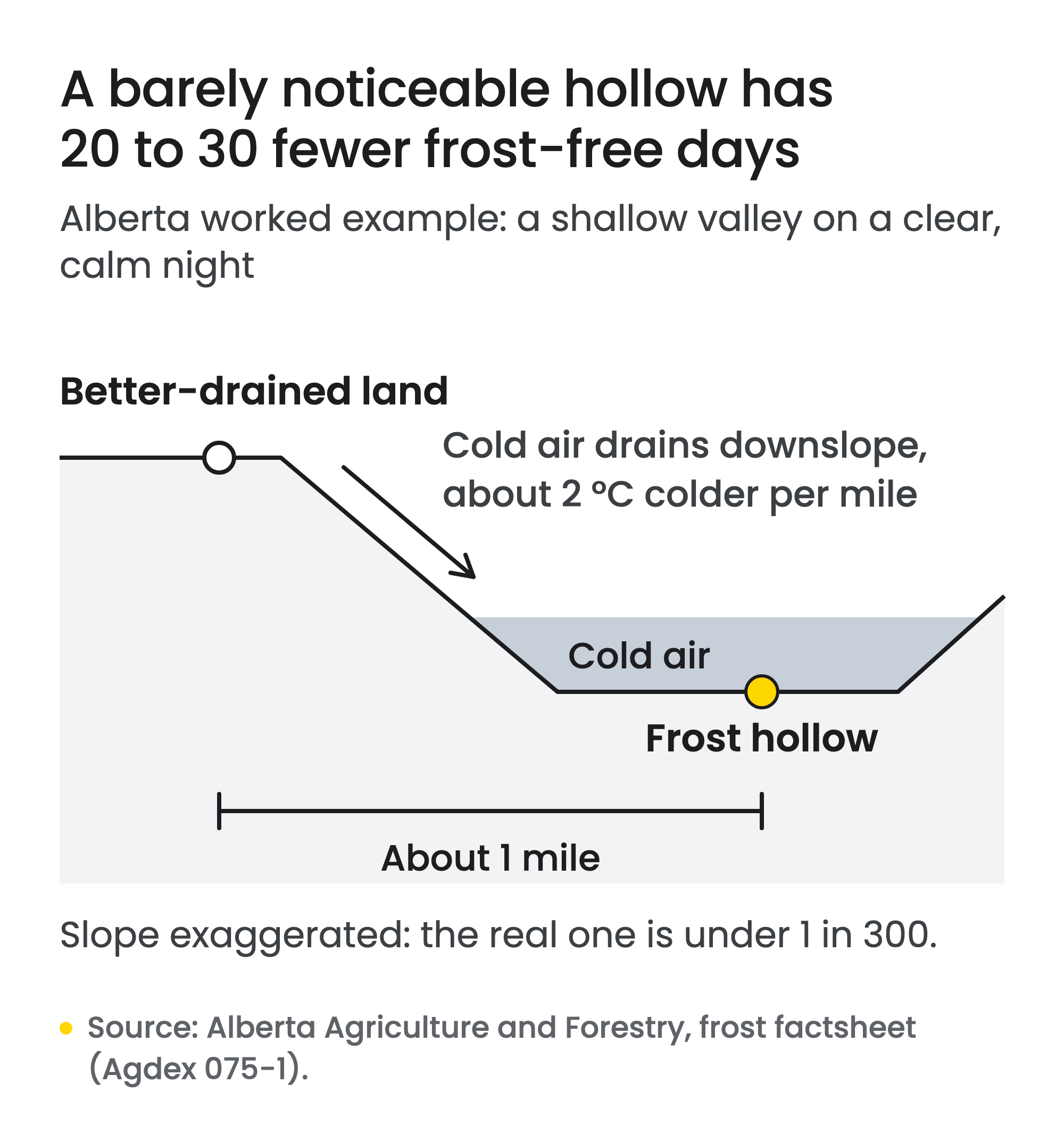
Two fields a mile apart can look equally flat and still have very different frost seasons. In a worked example from Alberta’s agriculture ministry, the lower field sits in a hollow whose slope is barely noticeable. Its frost-free period is still 20 to 30 days shorter. Reading a general frost forecast for one field calls for knowledge of the site, the ministry notes. An agricultural weather station inside the plot provides it.
Constellia wants to give each field its own forecast. Its website describes solar-charged devices that produce a weather forecast for the exact spot where each one is installed. In September the company was one of 12 that the Nexterre Program selected for its first phase, a maturation stage.
The short version
- An agricultural weather station usually sits inside a plot and records the conditions the crop actually gets.
- In an Alberta example, a barely noticeable hollow has a frost-free period 20 to 30 days shorter than land a mile away.
- On calm nights, air near the ground is often 1 to 6 °C colder than the standard shelter reading.
- Quebec’s Agrométéo network already combines about 270 stations and more than 100 bioclimatic models.
- Constellia says its devices produce a forecast for each site where one is installed. We found no independent test of those forecasts.
Why do neighbouring fields get different frosts?
Cold air is dense. On calm nights a thin layer of it forms near the ground and flows downslope wherever the land is not completely level. It settles in low spots known as frost hollows. Of all the weather factors that affect farming, minimum temperature is among the most variable from place to place, according to Alberta’s frost factsheet. A site-to-site difference of 1 °C in average minimum temperature can change the growing season by one to three weeks.
The factsheet’s first worked example shows how little slope it takes. It describes a shallow valley several miles wide and 100 to 150 feet deep, with an average slope under 1 in 300. On clear, calm nights, the temperature drops about 2 °C per mile toward the lowest point. The frost hollow at the bottom, nearly a mile across, has a frost-free period 20 to 30 days shorter than land a mile away with better cold-air drainage.
A standard thermometer misses part of this. It sits in a ventilated shelter about 4.5 feet above the ground. On calm nights, the air near ground level is often 1 to 6 °C colder than the shelter reading, depending on cloud cover. A standard minimum of 0 °C can therefore correspond to a killing frost in the crop.
What is an agricultural weather station for?
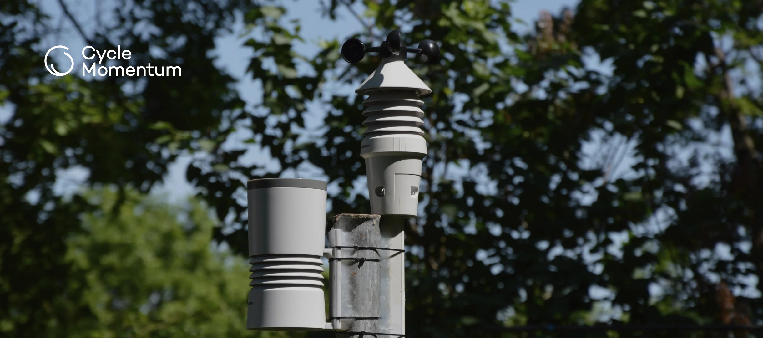
It serves crop protection, irrigation and farm management. An agricultural weather station is generally installed inside a plot, so it can measure local conditions very precisely, according to a CRAAQ leaflet written with Agriculture and Agri-Food Canada scientists. Its readings also feed forecasting models that combine a crop with its surroundings.
Pest forecasting is where that data does its most visible work. AAFC’s CIPRA software turns hourly weather into forecasts of insect, disease and crop development, so growers can pick the best time to apply plant protection measures. Orchards show why: apple scab infection risk is calculated from temperature and leaf wetness, as our post on how Quebec orchards fight apple scab explains.
That is the environmental case for weather data, and it is indirect. A station does not cut chemical use by itself. It helps a grower spray when a model says infection is likely, and AAFC says this approach contributes significantly to reducing pesticides in the environment. The pressure is growing. Since 1970, Canada has warmed nearly twice as fast as the global average, according to the 2026 edition of Canada’s Changing Climate Report. The report finds hot extremes already increasing and expects them to intensify with further warming.
What does Quebec’s public weather network already cover?
It covers a lot, so growers should start there. Agrométéo Québec starts with close to 170 stations run by La Financière agricole du Québec. Networks from Environment and Climate Change Canada, Hydro-Québec and the forest-fire agency SOPFEU bring the total to about 270. The platform serves heat units, degree-days, potential evapotranspiration and more than 100 bioclimatic models.
CIPRA’s models are among them. AAFC researchers in Saint-Jean-sur-Richelieu began the software in 1995, and it now holds more than 130 models for more than 25 crops.
The single field is where a public network runs out. A 2025 AAFC presentation reported results from one Quebec farm fitted with nine rain gauges: 70 to 90 mm of difference over the season. A few summer rain events differed by more than 10 to 15 mm. Degree-day totals barely differed from the reference station. The farm data proved its worth in extreme weather, for checking fields after storms.
Temperature totals such as degree-days, then, are well served. A station outside the field cannot see the hollow at the bottom of it, or a storm that missed the station. That takes an agricultural weather station in the field itself, placed with care, a lesson greenhouse growers also learn with their climate computers.
What does Constellia add?
Nexterre describes Constellia only in general terms, as a company working on the digitization, management and analysis of data to improve decisions. Its website is more specific. It offers microclimate weather forecasts that power hyperlocal early warnings, climate-smart agriculture and smart forests. Current forecasts rely on coarse satellite data that miss microclimates, the site argues.
Its hardware is built for remote sites: low-power devices with solar charging, GPS, long-range LoRa radio, WiFi and customizable sensors. The platform combines each device’s readings with satellite data and produces point-based forecasts wherever a device is installed. For farms, the company turns those forecasts into agronomic guidance. Seasonal forecasts help plan crops and medium-range ones guide daily decisions, with the stated aim of knowing what to sow, when to sow and when to harvest.
The site also claims that its AI forecasts are 65% more accurate than satellite data alone. It does not say how that was measured, and we found no independent evaluation.
Who is behind Constellia, and what has it tested?
Founder and CEO Brian Lee Yung Rowe has more than 20 years of experience in quantitative finance and a background in electrical engineering. In his newsletter, he says he formed Constellia in Quebec in September 2024, with headquarters in Montreal.
The newsletter also lists the progress since then, all self-reported. The first sensor deployment it lists came in April 2025, at a farm in New Jersey, where the sensors followed beet growth in different growing media. In Haute-Gaspésie, a range test made a radio link at 6.5 km.
Two grants followed in 2025. One, funded by the Quebec government through the Garage&Co incubator, supports commercialization. The other, funded by the Government of Canada through Valores, is meant to winterize the devices for Canadian winters. The newsletter does not give the amounts.
The decisive test is easy to describe. Put one device beside an Agrométéo station and another in the lowest corner of a nearby field, for one spring and one fall. The first shows whether its sensor reads like the public one. The second shows what the station misses: frost nights in the hollow, forecast early enough to protect a crop.
As a Nexterre partner, Cycle Momentum has a stake in how that test turns out. Teams building farm data tools can find out more about our agtech startup accelerator.